Introducing Globe Projections
Flight Data Visualization
Previously, you were limited to viewing your flight data visualizations on a flat mercator projection of the earth. Today, we're happy to announce support for globe projections in FlightMapper.io!
Flat mercator projection maps work for the majority of geo data visualization use cases, but when working with certain data sets (like flight paths!) at zoomed out levels, harnessing a more realistic projection of the earth's shape works best.
For example, the flight path arcs in the mercator version of FlightMapper.io technically do not show the shortest path between two points on the earth, but rather the shortest path on a mercator projected earth. This can be misleading at some times, as the path between the American west coast and Europe on a mercator map usually crosses over the continental United States on a straight line, when in reality the true shortest path crosses actually crosses near the north pole. On a spherical representation of the earth, these types of changes are visually prevalent.
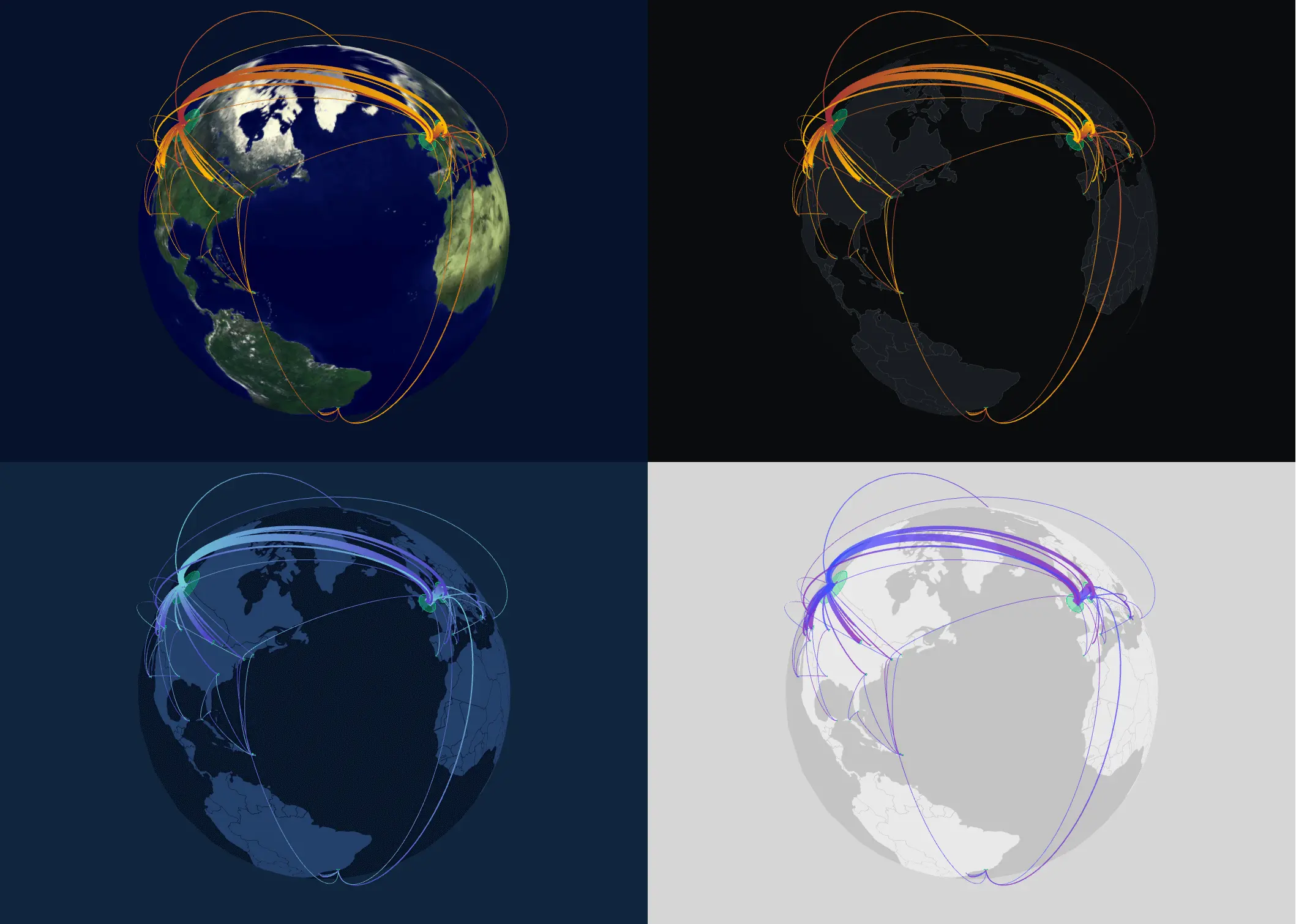
Globe Projections
The globe projection is currently available for all four themes: light, dark, blue, and satellite mode.
To switch your map to the globe projection and take advantage of a 3D spherical earth, go to "Display Settings" in the Editor page.
We hope you enjoy this new feature and like always, please reach out to us at help@flightmapper.io with any questions or issues.